Established in 1977, Costich Engineering, Land Surveying & Landscape Architecture, D.P.C. has been providing design and consulting services to public and private sector clients throughout the Northeastern region for over 49 years. The vast majority of work performed by our firm involves site development plans and approvals, including schematic and conceptual design, field and office survey, environmental review, environmental and wetland consulting, design development, municipal approvals, permitting, construction documents, easements, subdivisions, construction administration, construction stakeout, and inspections.
Our firm continues to excel due to dedicated staff, utilization of the latest technology and software, and our innovative project approach. We take pride in our work and believe in fostering long-lasting relationships with our clients. As a third-generation family business, Costich is now being led by our first-ever woman President and CEO.
Costich Engineering, Land Surveying & Landscape Architecture, D.P.C. is a New York State Certified Women-Owned Business. We are also a City of Rochester WBE Firm and a Monroe County Certified WBE Firm.
The Costich Survey Department provides comprehensive surveying and construction stakeout services for commercial, residential, educational, industrial, wireless telecommunications, and municipal projects. Our team supports every phase of site development by delivering accurate, reliable data that informs design, permitting, and construction.
We adapt to the needs of each site with flexible one-, two-, and three-person survey crews, equipped with advanced Leica Geosystems instruments, GPS receivers, and aerial drone technology. This approach ensures efficient data collection and precise measurements for boundary, topographic, and infrastructure surveys. Whether establishing control, documenting existing conditions, or providing as-built verification, our survey team ensures accuracy and consistency on every project.


The Mapping & Analysis Department provides the foundation for informed and efficient project planning. Our team combines GIS-based research, local database resources, and cross-collaboration with related professions to deliver comprehensive evaluations of site conditions and constraints.
Beyond GIS, our staff works closely with site inspectors, construction administration, landscape architecture, and civil engineering teams to expand site analysis capabilities. This includes soil and infiltration testing, visual impact studies using drone imagery and balloon flights, feasibility assessments, and concept or scenario modeling. Through this integrated approach, we help clients anticipate challenges, strengthen project schedules, and achieve lasting, successful developments.

Our Environmental Department supports a wide range of public and private projects across Western and Central New York, helping clients navigate environmental regulations efficiently and responsibly. The team provides comprehensive expertise in wetland delineations, environmental permitting, and ecological assessments under both state and federal jurisdiction.
Working in coordination with the New York State Department of Environmental Conservation (NYSDEC) and the U.S. Army Corps of Engineers (USACE), we ensure that each project meets regulatory requirements while maintaining design integrity and constructability. Our expertise includes permitting within freshwater and coastal zones, wetland delineation, and ecological restoration—delivering practical, science-based solutions that balance development objectives with environmental stewardship.

Collaboration between design disciplines is central to Costich’s approach. Our Landscape Architecture Department builds on that foundation, integrating aesthetics, functionality, and sustainability into every project.
Our licensed landscape architects bring a creative perspective to site planning by incorporating pedestrian-friendly design, green infrastructure, and visual harmony into technically sound engineering solutions. We specialize in streetscapes, urban design, parks, trails, and recreational spaces that enhance both community experience and long-term resilience.
The Civil Engineering Department at Costich provides comprehensive site design and infrastructure solutions for projects of all sizes and complexities. Our team includes engineers with a range of specialties, allowing us to deliver efficient, code-compliant designs tailored to each client’s goals.
We support projects across Western and Central New York, including residential, mixed-use, commercial, industrial, and wireless telecommunications developments. With expertise in grading, drainage, stormwater management, and green infrastructure, our engineers combine technical precision with practical design to create safe, sustainable, and buildable sites.

Costich has been providing wireless telecommunications services since 1988, when cell phones were first emerging in the suitcase and brick phone era. Our Telecommunications Department brings together a multidisciplinary team of project managers, CAD designers, surveyors, landscape architects, GIS professionals, drone pilots, and construction inspectors to support all phases of site development.
We take pride in producing high-quality designs and deliverables while maintaining the flexibility to meet evolving industry standards. With decades of experience and a deep understanding of regulatory and technical requirements, our team provides reliable solutions that keep our clients connected and projects moving forward.
1. Site Selection Analysis Phase:
2. Project Inception/Concept Phase:
3. Zoning Phase
4. Construction Phase

Our team has extensive experience coordinating municipal approvals and permit applications across all levels of government. We manage a wide range of documentation required for development projects, ensuring each submission is complete, accurate, and professionally presented.
Using a combination of Microsoft Office, Adobe Creative Suite, and Bluebeam, we streamline document preparation and enable real-time collaboration with clients and review agencies. From public hearings to interagency coordination, we guide projects smoothly through the approval process to keep timelines on track and communication clear.

Costich provides construction administration services to ensure a seamless transition from design documentation to on-site construction. We include this level of involvement in nearly every project, taking an active leadership role to maintain communication among clients, contractors, and design professionals.
Through long-standing relationships with regional contractors and consistent on-site observation, we help ensure each project is constructed as designed. Our licensed professionals are especially attentive to green infrastructure and complex site work, where proper implementation is essential to performance, quality, and compliance.
Our construction administration staff also provide seasonal site oversight, including SWPPP inspections, winterization preparation, and coordination with contractors to maintain compliance and protect site performance through changing conditions.

At Costich, we develop outreach and engagement strategies tailored to each community and project. Every location presents unique needs and perspectives, and our approach reflects that — no two engagement plans are alike. We collaborate closely with local municipalities, stakeholders, and area experts to build strategies that foster transparency, participation, and trust.
Our team utilizes a range of outreach tools, from in-person workshops and public meetings to digital communication platforms, ensuring that community input informs design and decision-making. By emphasizing flexibility and inclusivity, we help clients strengthen relationships and achieve meaningful, community-supported outcomes.

history
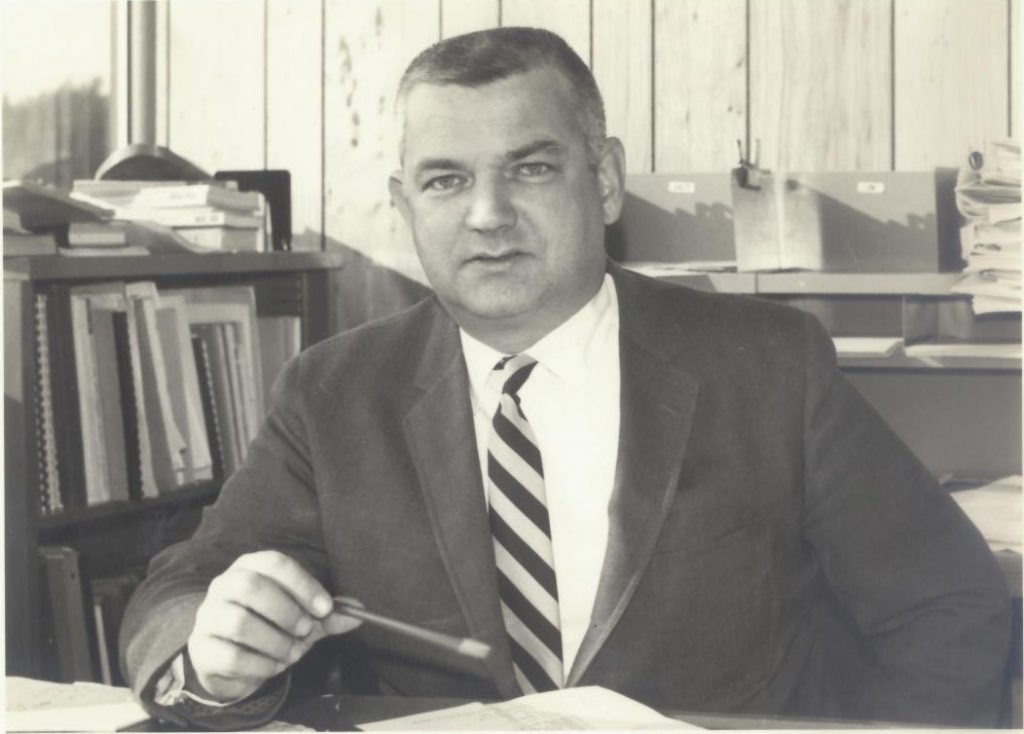
1956 | Syracuse University first Bachelor of Science in Civil Engineering (BSCE) Graduation Class
Then | Employed at Erdman & Anthony
Later | Employed at Lozier’s
1968 | He became partner of Sear, Brown, Schoenberger & Costich
1977 | The business ‘Charles J. Costich, P.E., L.S., P.C.’ was founded (later renamed Costich Engineering & Land Surveying, P.C.)
Costich Civil Engineering, Land Surveying & Landscape Architecture D.P.C. is a family business with highly motivated staff that strives to exceed client expectations. Our firm was established in 1977 and continues to grow, expanding our expertise and service offerings to suit our client’s needs. Whether you are a commercial or residential developer, represent an educational facility or municipality, or if you are looking for someone to partner with for an exciting project, count on Costich to provide you with cost-sensitive ideas, quality design and effective, lasting solutions.